 |
PowerCAD Pro
powerful & programmable 2D/3D CAD with unrivalled AutoCAD compatibility - XP & Vista
PowerCAD CE
world's first full powered CAD lineup, optimised specifically for Windows CE mobile/wireless computing |
|
 |
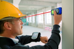
The world's first building surveying solution integrating CAD and exact data acquisition with architechtural functionality
SiteMaster Building - building surveying integrating CAD with distancemeters - the mobile solution for building surveys
SiteMaster BuildingLT - building surveying integrating CAD with distancemeters - low cost entry to creating digital floor plans
SiteMaster BuildingTS - building survey integrating CAD with distancemeter and total stations
SiteMaster TopoSurvey - land survey with total stations
SiteMaster Facade - facade survey with total stations
SiteMaster Elevation - photogrammetric facade survey
SiteMaster Office - floor plan editing back in the office |
 |
ProLog Borehole Logging Software
flexible borehole logging solution for Geological and Geotechnical Borehole Logging |
 |
Carlson Software
Software for land development professionals
Carlson SurvCE - powerful data collection for RTK GPS, Robotic or Conventional Total Stations
Carlson Field - XP version of Carlson SurvCE - data collection directly in CAD
For the Ultimate Field to Finish Solution,
combine SurveCE/Field with Carlson Survey 2009 or Carlson Civil Suite 2009 |
 |
Ezifield
data Collection system for surveyors and engineers, designed to operate on PDA/Field PC's
code and view data in the field with a direct interface on your PDA to your total station or GPS unit |
 |
EziCAD, EziCollect
Calculation & Design Software for Civil Engineers & Surveyors |
|
CDS |
CDS Cogo, CDS Model, CDS Road
Calculation & Design Software for Civil Engineers & Surveyors |


