
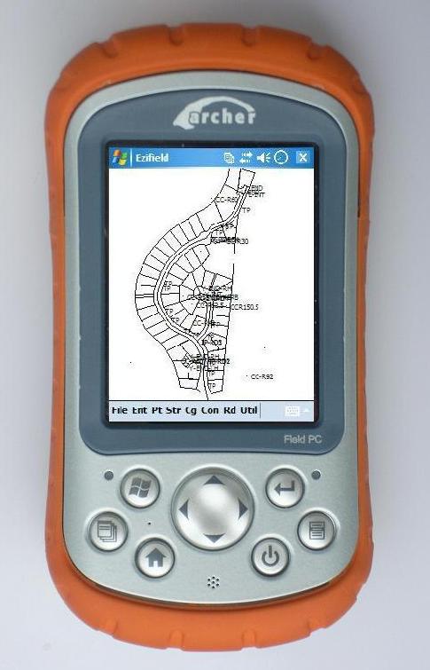
Survey Data Collection & Interactive Mapping in the Palm of your Hand
Ezifield is a turnkey data collection system designed for surveyors and engineers designed to operate on Pocket/Field PC's running Windows CE operating systems. Improve your overall efficiency as you collect, code and view the data in the field with a direct interface from Ezifield on your field PC to your total station or gps.
Currently data collection has two major shortcomings with the majority of total stations and gps systems:
- facilities to code the points as they are picked up are limited or non-existant
- you can't see the job until you get the data back to the office
These arise from the fact that the data collection procedure was designed to fit what the machine could do, not what you needed to do.
Ezifield will overcome both of these shortcomings and allow you to code with ease, and see the job as it progresses.
One picture is worth a million numbers
The quickest way to verify you are collecting enough data, or the right data is to look at the picture. No more traveling back to the base camp or the office to find you haven't picked up all the data points you need. No more stumbling around aimlessly in the undergrowth because you didn't have a clear picture of where you need to stake out the point.
No matter what shape the job might be, you can arrange the window to make sure you see the data as it is captured, while always having a full view of the job.
Zoom and pan facilities are provided to allow you to see greater details in areas of interest.
Coding made easy
Code the point by picking from the list or typing it in, or combine both, the choice is yours.
Ezifield allows you to create your own Code Lists, and easily apply those codes to the point by one touch of the stylus.
To improve your speed in the field, you can group the codes in the order you choose to ensure that those most commonly used are always displayed.
In addition, new or different codes can be entered individually using the virtual keyboard of your Pocket/Field PC. When you need to work for different clients, who each want their own particular codes used, the code lists can save you time, effort and mistakes.
Calculations on call
The most commonly used calculations are included so you can check as you go with routines for:
- traverse check & close
- bearing & distance calculations
- radiations
- intersect bearings &/or distances
- chainage/station & offset calculations
- parallel offset calculations
- route calculations allow quick and simple calculation of road and highway alignment, complete with spiral's from horizontal IP's
Model as you measure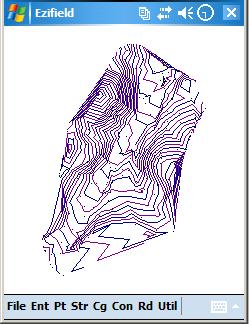
Ezifield allows you to form the triangulated model and the contours at your selected interval, so you can see whether the model 'looks right' as the job progresses.
You can select the points to include in the model, and the contour intervals.
Roads on the run
Ezifield lets you design the alignments, the design section templates and vertical design grading.
Section points and catch points can then be generated and staked on demand at any chainage or station you need.
Superelevation and variable lane widths are easily accomodated with simplified tabular entry.
Stake on the alignment or at any offset you choose, using a single template to simplify both cut and fill conditions. Stake points in any order to tame difficult terrain.
Simple data transfer
Ezifield will upload a data file directly to your desktop computer via a serial connection or Bluetooth if enabled. The format can be raw SDR33, coordinates in SDR33 format or CSV format.
Alternatively transfer the data file using the 'scnchronization' facility supplied with your Pocket/Field PC.
If you are running EziCAD or CDS on your desktop then you can use the Ezifield database directly.
For system requirements and more information, please download brochure (177Kb)

$660 inc gst 30-day money back guarantee
Request tax invoice (with payment options via email)